Maps
Battle of Princeton Map Details
The Battle of Princeton, fought on January 3, 1777, was a pivotal engagement during the Ten Crucial Days of the American Revolution. This key victory by General George Washington marked a turning point in the war and is commemorated today at Princeton Battlefield State Park, a designated National Historic Landmark.

Background: The Lead-Up to Battle
After successfully repelling British forces under Lieutenant General Lord Charles Cornwallis at the Battle of the Assunpink Creek in Trenton on the evening of January 2, 1777, Washington launched a bold nighttime maneuver. He led approximately 5,000 Continental troops around Cornwallis’s position, marching north toward Princeton with the goal of striking the British 4th Brigade, commanded by Lieutenant Colonel Charles Mawhood.
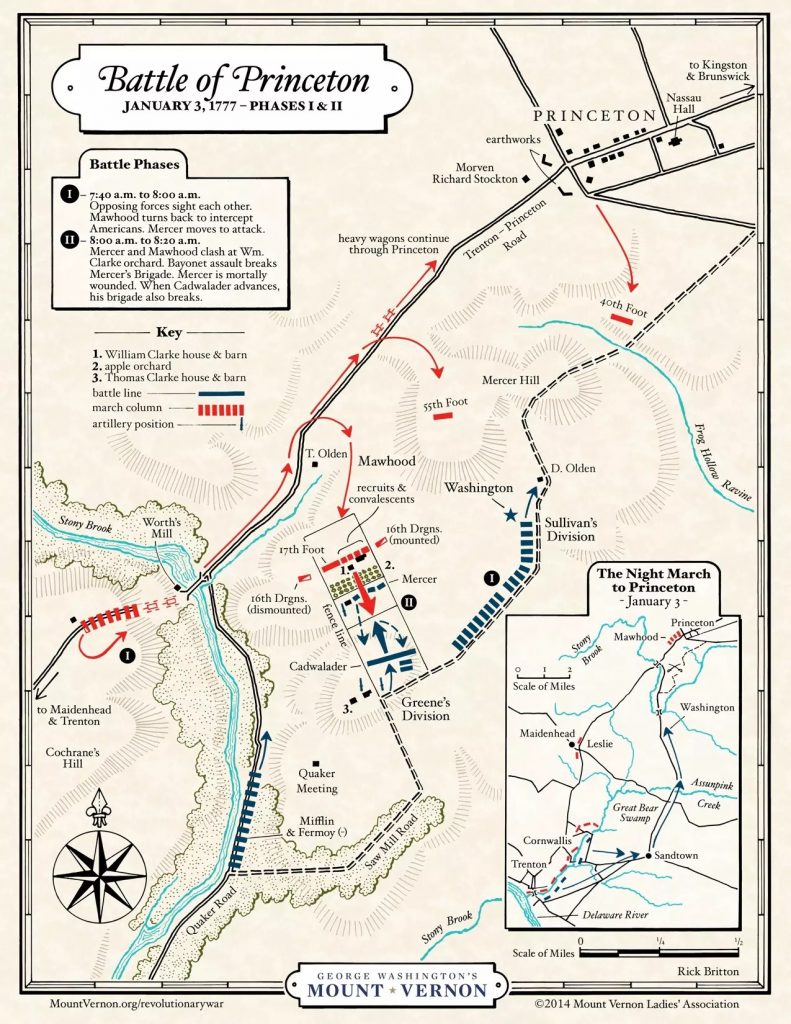
(See map Phases I and II for movement and positioning.)
The Battle Unfolds
As Washington approached Princeton from the southeast at dawn, he was unaware that Mawhood had received orders to reinforce Cornwallis in Trenton. Mawhood’s troops, already marching south along the Trenton-Princeton Road, unexpectedly encountered the Continental Army near Stony Brook, just south of Princeton.
Reacting quickly, Mawhood reversed his column and launched an assault on the left flank of the American forces, led by General Hugh Mercer. The initial British charge gained the upper hand, especially against Mercer’s Virginia brigade, and a fierce clash erupted on the Quaker farmland of William and Thomas Clarke.
Washington’s Counterattack and Victory
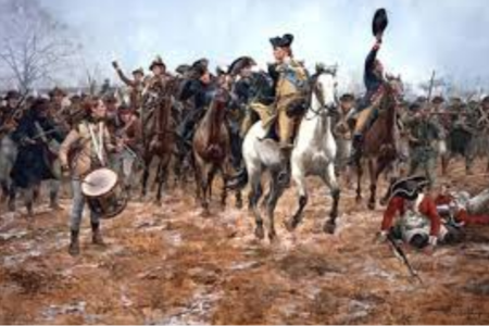
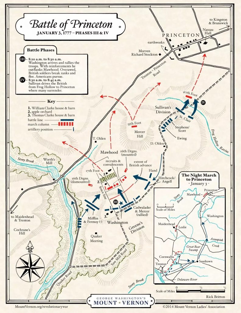
Seeing his forces faltering, Washington personally rode into battle, rallying his troops with a decisive counterattack. The Continental Army executed what historians describe as a near-organic double envelopment, surrounding Mawhood’s 17th Regiment, which numbered roughly 450 men.
Facing overwhelming force, Mawhood ordered a general retreat, scattering British troops in all directions—north, south, and west.
(See map Phases II and IV for troop engagements and retreat paths.)
Meanwhile, Brigadier General John Sullivan successfully surrounded and captured an additional 200 to 300 British soldiers who had taken refuge in Nassau Hall, the main building of the College of New Jersey (now Princeton University).
Aftermath and Strategic Significance
Following the American victory, Washington led his troops north to winter quarters in Morristown. The win at Princeton, coming on the heels of victories at Trenton and Assunpink Creek, was the third American triumph in just ten days.
The impact was profound:
-
British morale plummeted, forcing Cornwallis to withdraw to Brunswick, Staten Island, and New York.
-
American morale surged, leading to renewed enlistments and public support.
-
The British would never again occupy New Jersey, known then as the “Jersies.”
Today, the legacy of this crucial battle lives on in the preserved landscape of Princeton Battlefield State Park, one of the most important Revolutionary War sites in the United States.
The Battle of Princeton Mapping Project
In 2010, the Princeton Battlefield Society, with funding from the National Park Service’s American Battlefield Protection Program, commissioned an in-depth Military Terrain Analysis and Battle Narrative study.
Conducted by John Milner Associates (now Commonwealth Heritage Group, Inc.), this comprehensive report—commonly referred to as the Milner Report—analyzed:
-
Historical troop movements
-
Topographical features
-
Cultural and archaeological data
-
Battlefield landscape correlations
The Milner Report is widely regarded by military historians as the most detailed and authoritative study of the Battle of Princeton to date. It forms the foundation for battlefield preservation, public education, and continued historical interpretation of this essential Revolutionary War encounter.


